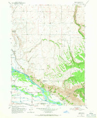
1951 Map of Heise
USGS Topo · Published 1971About this map
The Snake River dominates this mid-century landscape, carving a complex path through the valley where Butler Island sits amidst a network of intricate irrigation channels. The area is a nexus of geothermal activity, evidenced by Hot Springs, Elkhorn Warm Spring, and Hawley Warm Spring. Settlement patterns follow the river and the Union Pacific line, with the community of Heise positioned near a Ranger Station and the base of the mountains. This era shows an intensive agricultural effort through the naming of numerous water works like the Farmers Friend Canal, Enterprise Canal, and Poplar Loop Canal. To the east, the terrain rises sharply toward Kelly Mtn and the deep incision of Kelly Canyon, providing a stark contrast to the developed river flats where the Union Pacific railroad services small landings such as Byrne and Jenson.
Find a feature on this map
32 named features on this map. Tap any name to fly to it.
Don’t see what you’re looking for? This feature index may not catch every label — zoom into the map to look around manually.
Map Details
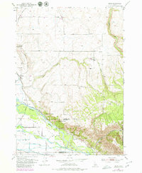
Editions of this 1951 Heise Map
3 editions found
Other maps of this area

1949 · Rexburg
USGS Topo · 1:24,000

1950 · Ririe
USGS Topo · 1:24,000

1950 · Rexburg
USGS Topo · 1:24,000

1950 · Rigby
USGS Topo · 1:62,500

1950 · Rigby SE
USGS Topo · 1:24,000

1951 · Rigby SE
USGS Topo · 1:24,000

1951 · Moody
USGS Topo · 1:24,000

1951 · Poplar
USGS Topo · 1:24,000

1951 · Hawley Gulch
USGS Topo · 1:24,000

1951 · Heise
USGS Topo · 1:24,000