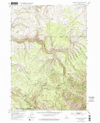
1951 Map of Hawley Gulch
USGS Topo · Published 1978About this map
Targhee National Forest defines this high-elevation Idaho landscape, where the administrative presence of the Hawley Gulch Ranger Station marks a key point of forest management. The terrain is deeply incised by drainages such as Moody Creek and its north and south forks, creating a network of ridges and canyons that shaped local access. The land shows evidence of early industrial activity with the Morning Glory Mine tucked into the slopes near Limekiln Canyon.
Find a feature on this map
34 named features on this map. Tap any name to fly to it.
Don’t see what you’re looking for? This feature index may not catch every label — zoom into the map to look around manually.
Map Details
Editions of this 1951 Hawley Gulch Map
Other maps of this area

1943 · Garns Mtn
USGS Topo · 1:62,500

1946 · Garns Mtn
USGS Topo · 1:62,500

1951 · Moody
USGS Topo · 1:24,000

1951 · Poplar
USGS Topo · 1:24,000

1951 · Hawley Gulch
USGS Topo · 1:24,000

1951 · Heise
USGS Topo · 1:24,000

1951 · Heise SE
USGS Topo · 1:24,000

1951 · White Owl Butte
USGS Topo · 1:24,000

1955 · Driggs
USGS Topo · 1:250,000

1958 · Driggs
USGS Topo · 1:250,000