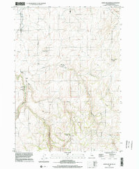
1998 Map of White Owl Butte
USGS Topo · Published 2002About this map
White Owl Butte and the surrounding volcanic uplands of Madison County dominate this late 20th-century topographic study. The landscape is defined by its drainage patterns and water management, with the Enterprise Canal cutting across the northern reaches and the winding path of Moody Creek carving a deep valley to the southwest. A sharp geological bend known as the Elbow of Moody Creek serves as a prominent landmark in the southwestern corner, while Long Hollow and Dry Canyon further articulate the rugged relief of the area.
Find a feature on this map
12 named features on this map. Tap any name to fly to it.
Don’t see what you’re looking for? This feature index may not catch every label — zoom into the map to look around manually.
Map Details
Editions of this 1998 White Owl Butte Map
This is the sole edition of this map. No revisions or reprints were ever made.
Other maps of this area

1943 · Garns Mtn
USGS Topo · 1:62,500

1946 · Garns Mtn
USGS Topo · 1:62,500

1949 · Newdale
USGS Topo · 1:24,000

1950 · Newdale
USGS Topo · 1:24,000

1950 · St Anthony
USGS Topo · 1:24,000

1951 · Moody
USGS Topo · 1:24,000

1951 · Hawley Gulch
USGS Topo · 1:24,000

1951 · Heise
USGS Topo · 1:24,000

1951 · White Owl Butte
USGS Topo · 1:24,000

1955 · Driggs
USGS Topo · 1:250,000