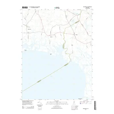
2014 Map of Heislerville
USGS Topo · Published 2014About this map
Delaware Bay defines the southern reach of this coastal landscape, where the tidal marshes of Cumberland and Cape May counties meet. The small inland settlements of Heislerville, Delmont, and Eldora are connected by a network of rural roads such as RT-47 and Hands Mill Rd, reflecting the historical agricultural and timber patterns of the region. The map shows an intricate system of coastal waterways including Dennis Cr, East Cr, and Roaring Ditch that weave through the wetlands toward the bay shore.
Find a feature on this map
45 named features on this map. Tap any name to fly to it.
Don’t see what you’re looking for? This feature index may not catch every label — zoom into the map to look around manually.
Map Details
Editions of this 2014 Heislerville Map
This is the sole edition of this map. No revisions or reprints were ever made.
Other maps of this area

1888 · Dennisville
USGS Topo · 1:62,500

1890 · Tuckahoe
USGS Topo · 1:62,500

1890 · Maurice Cove
USGS Topo · 1:62,500

1890 · Bridgeton
USGS Topo · 1:62,500

1891 · Maurice Cove
USGS Topo · 1:62,500

1893 · Tuckahoe
USGS Topo · 1:62,500

1894 · Dennisville
USGS Topo · 1:62,500

1894 · Bridgeton
USGS Topo · 1:62,500

1899 · Vineland
USGS Topo · 1:125,000

1918 · Tuckahoe
USGS Topo · 1:62,500
Featured Places
- Middle Township, NJ
- Maurice River Township, NJ
- Eldora, Dennis Township
- Heislerville, Maurice River Township
- Dennis Township, NJ