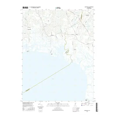
2016 Map of Heislerville
USGS Topo · Published 2016About this map
The Cumberland and Cape May county line bisects this coastal survey of the Delaware Bay shoreline, where low-lying salt marshes and tidal creeks meet inland pine forests. Small settlements like Heislerville, Delmont, and Eldora anchor the terrestrial landscape, connected by historic thoroughfares such as N Delsea Dr and Schoolhouse Ln. The transition from water to land is marked by several named shorelines, including Thompsons Beach, Moores Beach, and Reeds Beach, which illustrate the region's exposure to the shifting tides of the bay.
Find a feature on this map
51 named features on this map. Tap any name to fly to it.
Don’t see what you’re looking for? This feature index may not catch every label — zoom into the map to look around manually.
Map Details
Editions of this 2016 Heislerville Map
This is the sole edition of this map. No revisions or reprints were ever made.
Other maps of this area

1888 · Dennisville
USGS Topo · 1:62,500

1890 · Tuckahoe
USGS Topo · 1:62,500

1890 · Maurice Cove
USGS Topo · 1:62,500

1890 · Bridgeton
USGS Topo · 1:62,500

1891 · Maurice Cove
USGS Topo · 1:62,500

1893 · Tuckahoe
USGS Topo · 1:62,500

1894 · Dennisville
USGS Topo · 1:62,500

1894 · Bridgeton
USGS Topo · 1:62,500

1899 · Vineland
USGS Topo · 1:125,000

1918 · Tuckahoe
USGS Topo · 1:62,500
Featured Places
- Middle Township, NJ
- Maurice River Township, NJ
- Eldora, Dennis Township
- Heislerville, Maurice River Township
- Dennis Township, NJ