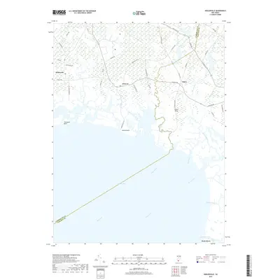
2019 Map of Heislerville
USGS Topo · Published 2019About this map
Delaware Bay dominates the southern reaches of this survey, where the saltwater interface shapes a coastline of marshy indentations and tidal drainage. The landscape is defined by its watercourses, notably West Creek, East Creek, and Dennis Creek, which meander through the low-lying terrain toward the bay. Small coastal outposts like Thompsons Beach and Moores Beach sit at the ends of isolated roads, while the interior is anchored by the historic crossroads of Heislerville, Delmont, and Eldora. The Cumberland and Cape May county line bisects the marshland, marking a political boundary in a region otherwise unified by its maritime character.
Find a feature on this map
47 named features on this map. Tap any name to fly to it.
Don’t see what you’re looking for? This feature index may not catch every label — zoom into the map to look around manually.
Map Details
Editions of this 2019 Heislerville Map
This is the sole edition of this map. No revisions or reprints were ever made.
Other maps of this area

1888 · Dennisville
USGS Topo · 1:62,500

1890 · Tuckahoe
USGS Topo · 1:62,500

1890 · Maurice Cove
USGS Topo · 1:62,500

1890 · Bridgeton
USGS Topo · 1:62,500

1891 · Maurice Cove
USGS Topo · 1:62,500

1893 · Tuckahoe
USGS Topo · 1:62,500

1894 · Dennisville
USGS Topo · 1:62,500

1894 · Bridgeton
USGS Topo · 1:62,500

1899 · Vineland
USGS Topo · 1:125,000

1918 · Tuckahoe
USGS Topo · 1:62,500
Featured Places
- Middle Township, NJ
- Maurice River Township, NJ
- Eldora, Dennis Township
- Heislerville, Maurice River Township
- Dennis Township, NJ