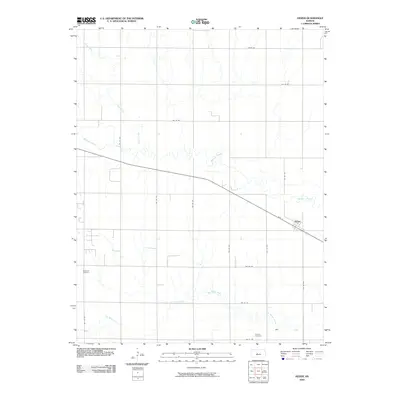
2009 Map of Heizer
USGS Topo · Published 2009About this map
Walnut Creek and its southern counterpart, Dry Walnut Creek, define the hydrological landscape of this central Kansas region near the close of the first decade of the 2000s. The small community of Heizer sits at a transportation juncture where Main St meets the rail line and state highway system, serving as the local hub for the surrounding Buffalo Township farmlands. This survey provides clear documentation of the rural road grid, including Olmitz Rd and numerous numbered avenues, which structure the agricultural economy of Barton County. For those tracing family history or local land use, the presence of Patterson Cemetery in the west and Everett Cemetery in the southeast offers critical markers of early settlement patterns and genealogical heritage in the prairie landscape.
Find a feature on this map
22 named features on this map. Tap any name to fly to it.
Don’t see what you’re looking for? This feature index may not catch every label — zoom into the map to look around manually.
Map Details
Editions of this 2009 Heizer Map
This is the sole edition of this map. No revisions or reprints were ever made.
Other maps of this area

1889 · Larned
USGS Topo · 1:125,000

1891 · Great Bend
USGS Topo · 1:125,000

1891 · Larned
USGS Topo · 1:125,000

1893 · Great Bend
USGS Topo · 1:125,000

1896 · Russell
USGS Topo · 1:125,000

1896 · Hays
USGS Topo · 1:125,000

1955 · Great Bend
USGS Topo · 1:250,000

1957 · Great Bend
USGS Topo · 1:250,000

1958 · Great Bend
USGS Topo · 1:250,000

1958 · Great Bend
USGS Topo · 1:24,000