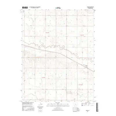
2015 Map of Heizer
USGS Topo · Published 2015About this map
The settlement of Heizer anchors the southeastern portion of this Barton County landscape, where the local grid meets at Main St, Byers Ave, and Bend Ave. The terrain is defined by the winding course of Walnut Cr, which meanders across the center of the sheet, supplemented by the parallel drainage of Dry Walnut Cr to the south and Boot Cr in the northwest. This agricultural region is punctuated by three distinct burial grounds that provide significant genealogical data for the surrounding townships. Saint Anthony Cem serves the northern reaches, while Patterson Cem and Everett Cem are situated in the southern sections, marking the established centers of these rural communities. The map depicts a highly organized township and range system, with an extensive network of roads like NW 120 Ave and NW 10 Rd facilitating travel between family farmsteads.
Find a feature on this map
32 named features on this map. Tap any name to fly to it.
Don’t see what you’re looking for? This feature index may not catch every label — zoom into the map to look around manually.
Map Details
Editions of this 2015 Heizer Map
This is the sole edition of this map. No revisions or reprints were ever made.
Other maps of this area

1889 · Larned
USGS Topo · 1:125,000

1891 · Great Bend
USGS Topo · 1:125,000

1891 · Larned
USGS Topo · 1:125,000

1893 · Great Bend
USGS Topo · 1:125,000

1896 · Russell
USGS Topo · 1:125,000

1896 · Hays
USGS Topo · 1:125,000

1955 · Great Bend
USGS Topo · 1:250,000

1957 · Great Bend
USGS Topo · 1:250,000

1958 · Great Bend
USGS Topo · 1:250,000

1958 · Great Bend
USGS Topo · 1:24,000