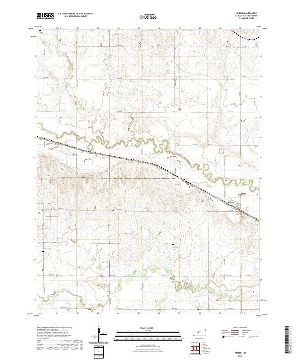
2022 Map of Heizer
USGS Topo · Published 2022About this map
The settlement of Heizer anchors the southeastern portion of this Barton County landscape, situated where the local road network of Main St and Bend Ave meets the prairie. This region is defined by its agrarian structure and the winding courses of Walnut Cr and Dry Walnut Cr, which meander through the central and southern sections. For genealogists and local historians, the map is a significant record of rural community landmarks, preserving the locations of Saint Anthony Cem in the northwest, Patterson Cem in the southwest, and both Clarence Township Cem and Everett Cem to the south. The precise grid of section lines, including NW 120 Ave and NW 90 Rd, illustrates the enduring Public Land Survey System that has shaped this Kansas territory since the nineteenth century.
Find a feature on this map
33 named features on this map. Tap any name to fly to it.
Don’t see what you’re looking for? This feature index may not catch every label — zoom into the map to look around manually.
Map Details
Editions of this 2022 Heizer Map
This is the sole edition of this map. No revisions or reprints were ever made.
Other maps of this area

1889 · Larned
USGS Topo · 1:125,000

1891 · Great Bend
USGS Topo · 1:125,000

1891 · Larned
USGS Topo · 1:125,000

1893 · Great Bend
USGS Topo · 1:125,000

1896 · Russell
USGS Topo · 1:125,000

1896 · Hays
USGS Topo · 1:125,000

1955 · Great Bend
USGS Topo · 1:250,000

1957 · Great Bend
USGS Topo · 1:250,000

1958 · Great Bend
USGS Topo · 1:250,000

1958 · Great Bend
USGS Topo · 1:24,000