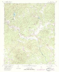
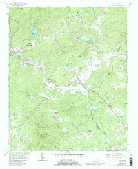
1957 Map of Helen
USGS Topo · Published 1986About this map
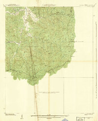
The upper reaches of the Chattahoochee River flow through this 1957 landscape, where the valley floor transitions into the southern Appalachian peaks. Centered on the Nacoochee Valley River, the map preserves the agricultural and spiritual layout of the region, anchored by the Indian Mound near Nacoochee. This archaeological landmark is surrounded by a network of rural community centers, including Bean Creek Ch and the Union Grove Chapel.
Find a feature on this map
51 named features on this map. Tap any name to fly to it.
Don’t see what you’re looking for? This feature index may not catch every label — zoom into the map to look around manually.
Map Details
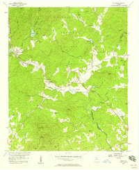
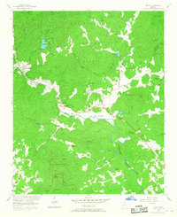
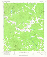
Editions of this 1957 Helen Map
5 editions found
Other maps of this area

1886 · Dahlonega
USGS Topo · 1:125,000

1892 · Dahlonega
USGS Topo · 1:125,000

1896 · Dahlonega
USGS Topo · 1:125,000

1903 · Dahlonega
USGS Topo · 1:125,000
1935 · Cowrock
USGS Topo · 1:24,000
1935 · Tray Mountain
USGS Topo · 1:24,000

1935 · Jacks Gap
USGS Topo · 1:24,000
1938 · Cowrock
USGS Topo · 1:24,000

1938 · Jacks Gap
USGS Topo · 1:24,000
1938 · Tray Mountain
USGS Topo · 1:24,000