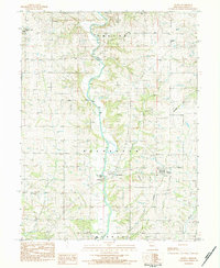
1983 Map of Helena
USGS Topo · Published 1984About this map
The Platte River meanders through Andrew County, Missouri, anchoring a landscape defined by small river settlements and early transport infrastructure. Near the river's bend, the village of Rochester sits adjacent to the Rochester Falls Campground, while the town of Helena serves as a secondary focal point to the east. The map records several notable community landmarks including Bedford Chapel and Long Branch Ch, each with nearby cemeteries that offer significant value for genealogical research.
Find a feature on this map
21 named features on this map. Tap any name to fly to it.
Don’t see what you’re looking for? This feature index may not catch every label — zoom into the map to look around manually.
Map Details
Editions of this 1983 Helena Map
This is the sole edition of this map. No revisions or reprints were ever made.
Other maps of this area

1923 · Clarksdale
USGS Topo · 1:62,500

1924 · St. Joseph
USGS Topo · 1:62,500

1925 · Clarksdale
USGS Topo · 1:62,500

1925 · Stanberry
USGS Topo · 1:62,500

1926 · Saint Joseph
USGS Topo · 1:62,500

1927 · Bolckow
USGS Topo · 1:62,500

1939 · Stanberry
USGS Topo · 1:62,500

1943 · Stanberry
USGS Topo · 1:62,500

1945 · Bolckow
USGS Topo · 1:62,500

1950 · Kansas City
USGS Topo · 1:250,000