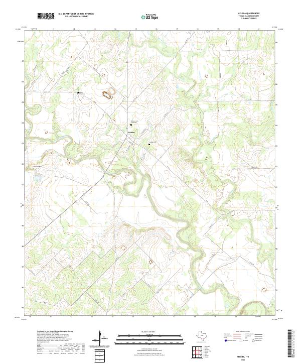
2022 Map of Helena
USGS Topo · Published 2022About this map
Helena sits at the center of this rural South Texas landscape, defined by the winding course of the San Antonio River and its numerous tributaries. Once a prominent county seat, the settlement is now a focused area of local history, where genealogists can find multiple burial sites including the Helena Cem, the Masonic Cem of Helena, and the Helena Latin Cem. The terrain is characterized by the confluence of major drainages like Ecleto Cr and Cibolo Cr, which carved the surrounding plains.
Find a feature on this map
39 named features on this map. Tap any name to fly to it.
Don’t see what you’re looking for? This feature index may not catch every label — zoom into the map to look around manually.
Map Details
Editions of this 2022 Helena Map
This is the sole edition of this map. No revisions or reprints were ever made.
Other maps of this area

1920 · Smiley
USGS Topo · 1:125,000

1953 · Beeville
USGS Topo · 1:250,000

1953 · Seguin
USGS Topo · 1:250,000

1956 · Beeville
USGS Topo · 1:250,000

1956 · Karnes City
USGS Topo · 1:62,500

1958 · Seguin
USGS Topo · 1:250,000

1960 · Beeville
USGS Topo · 1:250,000
1960 · Karnes City
USGS Topo · 1:24,000

1960 · Kosciusko
USGS Topo · 1:24,000

1960 · Helena
USGS Topo · 1:24,000