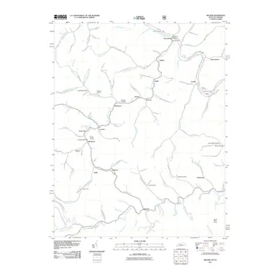
2011 Map of Hellier
USGS Topo · Published 2011About this map
The Allegheny Mine and the industrial corridors along Marrowbone Creek characterize this 2011 survey of eastern Kentucky. The landscape is defined by its coal-mining history and the deep hollows of the Cumberland Plateau, where settlements like Hellier, Ashcamp, and Marrowbone follow the winding valley floors. In the northeast corner, the Russell Fork river passes through Draffin, with the Regina Post Office serving as a local hub. Genealogy researchers will find several family-named burial sites, including the Martha Johnson Cemetery near Big Branch and the Ratliff Cemetery overlooking the river. The map also documents numerous smaller hollows such as Graveyard Hollow, Narrow Hollow, and Childers Hollow, reflecting the localized settlement patterns of the region.
Find a feature on this map
120 named features on this map. Tap any name to fly to it.
Don’t see what you’re looking for? This feature index may not catch every label — zoom into the map to look around manually.
Map Details
Editions of this 2011 Hellier Map
This is the sole edition of this map. No revisions or reprints were ever made.
Other maps of this area

1886 · Grundy
USGS Topo · 1:125,000

1890 · Whitesburg
USGS Topo · 1:125,000

1890 · Grundy
USGS Topo · 1:125,000

1892 · Grundy
USGS Topo · 1:125,000

1892 · Whitesburg
USGS Topo · 1:125,000

1912 · Pound
USGS Topo · 1:48,000

1913 · Clintwood
USGS Topo · 1:62,500

1914 · Pound
USGS Topo · 1:62,500

1914 · Vergie
USGS Topo · 1:48,000

1915 · Clintwood
USGS Topo · 1:62,500