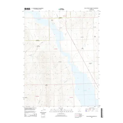
2014 Map of Hells Kitchen Canyon SW
USGS Topo · Published 2014About this map
Sevier Bridge Reservoir dominates the lowlands of this high-desert landscape on the border of Juab and Sanpete Counties. The terrain is defined by the eastern slopes of the Valley Mountains, which give way to a complex series of drainage features including Red Canyon and Painted Rock Canyon. These geological features reflect the arid erosional patterns of the Great Basin, where named landforms like Painted Rocks and Cedar Ridge provided essential landmarks for early travelers and surveyors. In the southern portion of the quadrangle, the presence of Dick and Dalton Flat suggests early ranching or settlement footprints in an otherwise sparsely populated region. A network of secondary roads and trails, such as Yuba Lake Rd and Hayes Canyon Rd, trace the natural contours of the canyons and the shoreline of the reservoir, illustrating how topography dictates movement through this part of Utah.
Find a feature on this map
21 named features on this map. Tap any name to fly to it.
Don’t see what you’re looking for? This feature index may not catch every label — zoom into the map to look around manually.
Map Details
Editions of this 2014 Hells Kitchen Canyon SW Map
This is the sole edition of this map. No revisions or reprints were ever made.
Other maps of this area
1885 · Manti
USGS Topo · 1:250,000

1885 · Sevier Desert
USGS Topo · 1:250,000
1895 · Manti
USGS Topo · 1:250,000
1952 · Scipio North
USGS Topo · 1:62,500

1953 · Delta
USGS Topo · 1:250,000
1956 · Price
USGS Topo · 1:250,000

1958 · Delta
USGS Topo · 1:250,000
1960 · Price
USGS Topo · 1:250,000
1962 · Price
USGS Topo · 1:250,000

1962 · Delta
USGS Topo · 1:250,000