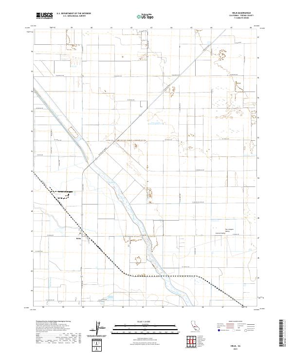
2021 Map of Helm
USGS Topo · Published 2021About this map
The settlement of Helm serves as a focal point in this portion of the San Joaquin Valley, where the landscape is defined by an intricate network of irrigation and water management. The hydrology of the Central Valley is on full display through the winding course of the Fresno Slough and Fish Slough, alongside engineered features like the James Bypass and the Stinson Canal. These waterways underscore the region's total transformation into a productive agricultural heartland, partitioned by a rigid grid of roads such as Colorado Rd and S McMullin Grade. The survey reveals a landscape of high efficiency, where historical natural drainages have been adapted into a system of canals and bypasses to sustain the surrounding valley farms.
Find a feature on this map
35 named features on this map. Tap any name to fly to it.
Don’t see what you’re looking for? This feature index may not catch every label — zoom into the map to look around manually.
Map Details
Editions of this 2021 Helm Map
This is the sole edition of this map. No revisions or reprints were ever made.
Other maps of this area

1912 · Coalinga
USGS Topo · 1:125,000

1923 · Kearney Park
USGS Topo · 1:31,680

1924 · Jamesan
USGS Topo · 1:31,680

1925 · Helm
USGS Topo · 1:31,680

1925 · San Joaquin
USGS Topo · 1:31,680

1925 · Raisin
USGS Topo · 1:31,680

1927 · Burrel
USGS Topo · 1:31,680

1931 · Wheatville
USGS Topo · 1:31,680

1931 · Towne Oil Station
USGS Topo · 1:31,680
1946 · Kearney Park
USGS Topo · 1:24,000