
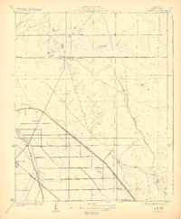
1924 Map of Jamesan
USGS Topo · Published 1924About this map
The central San Joaquin Valley landscape captured here reflects the early 20th-century transition to large-scale irrigation and commercial agriculture. Centered on the settlement of Jamesan, the area is defined by the rigid alignment of the Southern Pacific railroad and the engineered water systems that transformed the arid plains of Fresno County. The Kings River Slough and Enterprise Canal illustrate the complex hydraulic infrastructure necessary to support the local economy, while the presence of Tranquillity to the southwest marks the emerging town centers of the era. The survey, conducted by C.A. Stonesifer and R.H. Runyan in 1922, demonstrates how the traditional overland routes like Whites Bridge Road were being supplemented by new flood control and transport features like the Main Bypass. This map is particularly valuable for tracing the precise paths of irrigation works before modern consolidation changed the rural footprint.
Find a feature on this map
8 named features on this map. Tap any name to fly to it.
Don’t see what you’re looking for? This feature index may not catch every label — zoom into the map to look around manually.
Map Details
Editions of this 1924 Jamesan Map
2 editions found
Other maps of this area

1921 · Mendota
USGS Topo · 1:31,680

1923 · Englebrecht Ranch
USGS Topo · 1:31,680

1923 · Biola
USGS Topo · 1:31,680

1924 · Tranquillity
USGS Topo · 1:31,680

1924 · Gravelly Ford
USGS Topo · 1:31,680

1924 · Mendota
USGS Topo · 1:31,680

1925 · Helm
USGS Topo · 1:31,680

1925 · San Joaquin
USGS Topo · 1:31,680

1946 · Tranquillity
USGS Topo · 1:62,500
1946 · Firebaugh
USGS Topo · 1:62,500