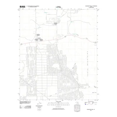
2010 Map of Helms West Well
USGS Topo · Published 2010About this map
The settlement of Butterfield and its surrounding colonia developments define this landscape on the western edge of the Hueco Mountains. At this point in the early 21st century, the residential grid is clearly visible, expanding into the desert scrubland of El Paso County. The map provides a detailed view of these specific housing clusters, including Butterfield City Number 1 Colonia and Butterfield City Number 4 Colonia, which reflect the unique rural-to-urban transition of the region.
Find a feature on this map
28 named features on this map. Tap any name to fly to it.
Don’t see what you’re looking for? This feature index may not catch every label — zoom into the map to look around manually.
Map Details
Editions of this 2010 Helms West Well Map
This is the sole edition of this map. No revisions or reprints were ever made.
Other maps of this area

1896 · El Paso
USGS Topo · 1:125,000

1903 · Cerro Alto
USGS Topo · 1:125,000

1908 · El Paso
USGS Topo · 1:125,000

1939 · Heuco Tanks
USGS Topo · 1:62,500

1940 · Heuco Tanks
USGS Topo · 1:62,500

1941 · Clint
USGS Topo · 1:62,500

1941 · Heuco Mountains
USGS Topo · 1:62,500

1942 · Borrego
USGS Topo · 1:62,500

1943 · Heuco Mountains
USGS Topo · 1:62,500

1944 · Heuco Tanks
USGS Topo · 1:62,500
Featured Places
- Butterfield, TX
- Butterfield City Number 1 Colonia, TX
- Butterfield City Number 2 Colonia, TX
- Butterfield City Number 3 Colonia, TX
- Butterfield City Number 4 Colonia, TX