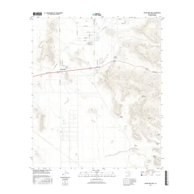
2016 Map of Helms West Well
USGS Topo · Published 2016About this map
Butterfield serves as a small residential hub near the Hueco Mountains in this western Texas landscape. The region’s historic transit identity is preserved through contemporary roads named for earlier paths, such as the Butterfield Trl and Overland Stage Rd. These routes cross a terrain defined by desert drainage patterns and ranching infrastructure, including the namesake Helms West Well. Water management in this arid environment is evident through numerous named tanks such as Neals Tank, Mikes Tank, and Pow Wow Tank, which dot the landscape near the canyons. The eastern edge of the map rises into the ridges of the mountains, cut by distinctive geological features like Pow Wow Canyon, Martin Canyon, and Phone Line Canyon. This survey captures the intersection of expanding residential development along Montana Ave with the traditional land use of the Chihuahuan Desert.
Find a feature on this map
43 named features on this map. Tap any name to fly to it.
Don’t see what you’re looking for? This feature index may not catch every label — zoom into the map to look around manually.
Map Details
Editions of this 2016 Helms West Well Map
This is the sole edition of this map. No revisions or reprints were ever made.
Other maps of this area

1896 · El Paso
USGS Topo · 1:125,000

1903 · Cerro Alto
USGS Topo · 1:125,000

1908 · El Paso
USGS Topo · 1:125,000

1939 · Heuco Tanks
USGS Topo · 1:62,500

1940 · Heuco Tanks
USGS Topo · 1:62,500

1941 · Clint
USGS Topo · 1:62,500

1941 · Heuco Mountains
USGS Topo · 1:62,500

1942 · Borrego
USGS Topo · 1:62,500

1943 · Heuco Mountains
USGS Topo · 1:62,500

1944 · Heuco Tanks
USGS Topo · 1:62,500
Featured Places
- Butterfield, TX
- Butterfield City Number 1 Colonia, TX
- Butterfield City Number 2 Colonia, TX
- Butterfield City Number 3 Colonia, TX
- Butterfield City Number 4 Colonia, TX