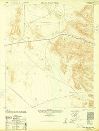
1948 Map of Helms West Well
USGS Topo · Published 1948About this map
Hueco Mountains define the eastern edge of this arid landscape in El Paso County, where topographic contours reveal steep slopes and high-elevation basins. At the center of this sparse terrain lies Helms West Well, a critical water point for ranching operations in a region otherwise marked by a small Reservoir and dry washes. The infrastructure of the mid-20th century energy boom is evident in the El Paso Natural Gas Company Pipe Line Road, which cuts a distinct path through the desert floor. This 1948 civil edition, derived from military aerial photography and field-edited in 1947, documents the early post-war expansion of industrial utilities across the West Texas borderlands.
Find a feature on this map
4 named features on this map. Tap any name to fly to it.
Don’t see what you’re looking for? This feature index may not catch every label — zoom into the map to look around manually.
Map Details
Editions of this 1948 Helms West Well Map
This is the sole edition of this map. No revisions or reprints were ever made.
Other maps of this area

1896 · El Paso
USGS Topo · 1:125,000

1903 · Cerro Alto
USGS Topo · 1:125,000

1908 · El Paso
USGS Topo · 1:125,000

1939 · Heuco Tanks
USGS Topo · 1:62,500

1940 · Heuco Tanks
USGS Topo · 1:62,500

1941 · Clint
USGS Topo · 1:62,500

1941 · Heuco Mountains
USGS Topo · 1:62,500

1942 · Borrego
USGS Topo · 1:62,500

1943 · Heuco Mountains
USGS Topo · 1:62,500

1944 · Heuco Tanks
USGS Topo · 1:62,500
Featured Places
- Butterfield City Number 4 Colonia, TX
- Butterfield City Number 1 Colonia, TX
- Hueco Mountain Estates Number 9 Colonia, TX
- Butterfield, TX
- Butterfield City Number 2 Colonia, TX