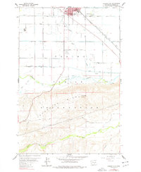
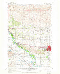
1958 Map of Hembre Mtn
USGS Topo · Published 1978About this map
Toppenish serves as the central hub in this mid-century survey of the Yakima Indian Reservation. The town is well-developed with a grid of streets including Division St and West Fourth Ave, supporting local landmarks like the hospital and Rodeo Grounds. South of the irrigated agricultural lands and the Northern Pacific tracks, the terrain rises sharply into the Toppenish Ridge, crowned by Hembre Mtn. The landscape reveals a complex network of water management, with Toppenish Creek and Wanity Slough meandering through the valley. This map effectively illustrates the transition from the high-desert elevation of Satus Creek to the reclaimed farmlands and recreational areas like the Mt Adams Golf and Country Club, showcasing the regional importance of the Yakima Valley's rail-and-water economy.
Find a feature on this map
41 named features on this map. Tap any name to fly to it.
Don’t see what you’re looking for? This feature index may not catch every label — zoom into the map to look around manually.
Map Details
Editions of this 1958 Hembre Mtn Map
2 editions found
Other maps of this area

1910 · Zillah
USGS Topo · 1:125,000

1950 · Yakima
USGS Topo · 1:250,000

1958 · Hembre Mtn
USGS Topo · 1:24,000

1958 · Toppenish SW
USGS Topo · 1:24,000
1958 · Toppenish
USGS Topo · 1:24,000
1958 · Wapato
USGS Topo · 1:24,000

1958 · Yakima
USGS Topo · 1:250,000

1961 · Yakima
USGS Topo · 1:250,000
1965 · Bluelight NW
USGS Topo · 1:24,000
1965 · Granger
USGS Topo · 1:62,500