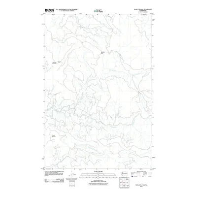
2011 Map of Hemlock Pass
USGS Topo · Published 2011About this map
The Coweeman River carves a central path through this forested landscape in Cowlitz County, joined by numerous tributaries including Mulholland Creek and Sam Smith Creek. This territory is defined by its significant relief, rising to peaks like Meridian Mountain and Smith Mountain. On the western slopes of Meridian Mountain, the Meridian Lookout stands as a point of high-elevation observation overlooking the Ostrander Creek drainage.
Find a feature on this map
17 named features on this map. Tap any name to fly to it.
Don’t see what you’re looking for? This feature index may not catch every label — zoom into the map to look around manually.
Map Details
Editions of this 2011 Hemlock Pass Map
This is the sole edition of this map. No revisions or reprints were ever made.
Other maps of this area

1921 · Kalama
USGS Topo · 1:62,500

1941 · Olequa
USGS Topo · 1:62,500

1942 · Toutle
USGS Topo · 1:62,500

1943 · Pigeon Springs
USGS Topo · 1:62,500

1953 · Hoquiam
USGS Topo · 1:250,000

1953 · Toutle
USGS Topo · 1:62,500

1953 · Castle Rock
USGS Topo · 1:62,500

1953 · Mt. Brynion
USGS Topo · 1:24,000

1953 · Pigeon Springs
USGS Topo · 1:62,500
1953 · Kalama
USGS Topo · 1:24,000