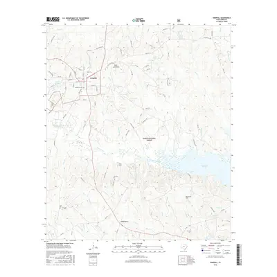
2016 Map of Hemphill
USGS Topo · Published 2016About this map
Hemphill serves as the focal point for this survey of eastern Texas, where the town grid transitions into the dense woodlands of the Sabine National Forest. The landscape is defined by the expansive northern reaches of the Toledo Bend Reservoir, which feeds into a complex network of bayous and creeks including Housen Bayou and Nickols Creek. The distribution of family-named cemeteries throughout the rural terrain, such as the John Smith Cemetery and Gomer Family Cemetery, offers significant insight for genealogists tracing early settlers in this timber-rich region.
Find a feature on this map
101 named features on this map. Tap any name to fly to it.
Don’t see what you’re looking for? This feature index may not catch every label — zoom into the map to look around manually.
Map Details
Editions of this 2016 Hemphill Map
This is the sole edition of this map. No revisions or reprints were ever made.
Other maps of this area

1944 · Negreet
USGS Topo · 1:62,500

1944 · Wiergate
USGS Topo · 1:62,500

1948 · Wiergate
USGS Topo · 1:62,500

1953 · Alexandria
USGS Topo · 1:250,000

1954 · Columbus
USGS Topo · 1:24,000

1954 · Fairdale
USGS Topo · 1:24,000

1954 · Negreet
USGS Topo · 1:62,500

1954 · Wiergate
USGS Topo · 1:62,500

1954 · Salter Creek
USGS Topo · 1:24,000

1955 · Alexandria
USGS Topo · 1:250,000