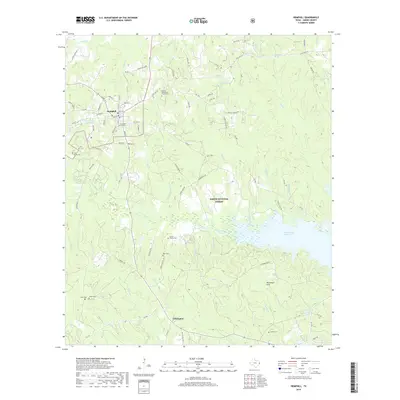
2019 Map of Hemphill
USGS Topo · Published 2019About this map
The town of Hemphill serves as a gateway to the dense woodlands of the Sabine National Forest, where the landscape transitions into the sprawling waters of the Toledo Bend Reservoir. This survey highlights a region defined by its timber heritage and family lineage, visible through numerous rural burial grounds such as the Gomer Family Cem, John Smith Cem, and the Baptist Macedonia Church Cem. To the south, the community of Yellowpine sits near the winding course of Conner Cr and the heights of the McLemore Hills. The complex hydrography of the area is evident in the many tributaries feeding the reservoir, including Housen Bayou and Sulphur Lick Br. These waterways and small impoundments like City Lake Number 2 illustrate the importance of water management and recreation in this East Texas borderland.
Find a feature on this map
81 named features on this map. Tap any name to fly to it.
Don’t see what you’re looking for? This feature index may not catch every label — zoom into the map to look around manually.
Map Details
Editions of this 2019 Hemphill Map
This is the sole edition of this map. No revisions or reprints were ever made.
Other maps of this area

1944 · Negreet
USGS Topo · 1:62,500

1944 · Wiergate
USGS Topo · 1:62,500

1948 · Wiergate
USGS Topo · 1:62,500

1953 · Alexandria
USGS Topo · 1:250,000

1954 · Columbus
USGS Topo · 1:24,000

1954 · Fairdale
USGS Topo · 1:24,000

1954 · Negreet
USGS Topo · 1:62,500

1954 · Wiergate
USGS Topo · 1:62,500

1954 · Salter Creek
USGS Topo · 1:24,000

1955 · Alexandria
USGS Topo · 1:250,000