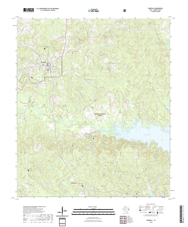
2022 Map of Hemphill
USGS Topo · Published 2022About this map
The Sabine County Courthouse in Hemphill serves as the focal point for this East Texas landscape, where the town’s grid meets the expansive reaches of the Sabine National Forest. The topography is defined by the massive Toledo Bend Reservoir, which dominates the eastern half of the map, submerging historical drainages like Housen Bayou and Nickols Cr. This recent survey details the interface between the established settlement at Hemphill and the timberlands to the south near Yellowpine.
Find a feature on this map
93 named features on this map. Tap any name to fly to it.
Don’t see what you’re looking for? This feature index may not catch every label — zoom into the map to look around manually.
Map Details
Editions of this 2022 Hemphill Map
This is the sole edition of this map. No revisions or reprints were ever made.
Other maps of this area

1944 · Negreet
USGS Topo · 1:62,500

1944 · Wiergate
USGS Topo · 1:62,500

1948 · Wiergate
USGS Topo · 1:62,500

1953 · Alexandria
USGS Topo · 1:250,000

1954 · Columbus
USGS Topo · 1:24,000

1954 · Fairdale
USGS Topo · 1:24,000

1954 · Negreet
USGS Topo · 1:62,500

1954 · Wiergate
USGS Topo · 1:62,500

1954 · Salter Creek
USGS Topo · 1:24,000

1955 · Alexandria
USGS Topo · 1:250,000