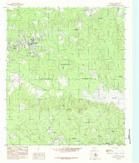
1984 Map of Hemphill
USGS Topo · Published 1984About this map
The county seat of Hemphill serves as the focal point for this 1980s-era study of East Texas timberlands and water resources. The landscape is dominated by the dense canopy of the Sabine National Forest, a terrain characterized by numerous natural springs like Turpentine Spring and Smiley Spring that feed into a complex network of creeks. To the east and south, the presence of the Toledo Bend Reservoir reflects the mid-century transformation of the Sabine River valley, which reshaped the geography of local settlements. Local history is anchored by East Mayfield and the community of Yellowpine, where the Yellowpine Lookout Tower stands as a landmark of forest management. The map details the drainage patterns of the Mc Lemore Hills and identifies distinct water features such as Housen Bayou and Yellowpine Lake, illustrating the rural character of Sabine County before significant modern expansion.
Find a feature on this map
38 named features on this map. Tap any name to fly to it.
Don’t see what you’re looking for? This feature index may not catch every label — zoom into the map to look around manually.
Map Details
Editions of this 1984 Hemphill Map
This is the sole edition of this map. No revisions or reprints were ever made.
Other maps of this area

1944 · Negreet
USGS Topo · 1:62,500

1944 · Wiergate
USGS Topo · 1:62,500

1948 · Wiergate
USGS Topo · 1:62,500

1953 · Alexandria
USGS Topo · 1:250,000

1954 · Columbus
USGS Topo · 1:24,000

1954 · Fairdale
USGS Topo · 1:24,000

1954 · Negreet
USGS Topo · 1:62,500

1954 · Wiergate
USGS Topo · 1:62,500

1954 · Salter Creek
USGS Topo · 1:24,000

1955 · Alexandria
USGS Topo · 1:250,000