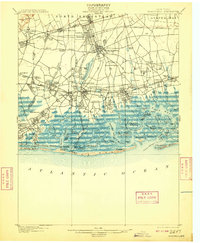
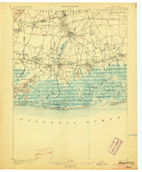
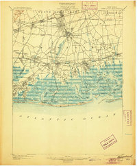
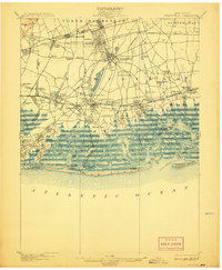
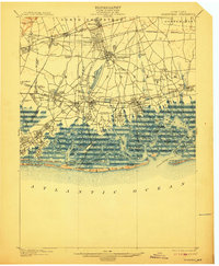
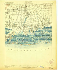
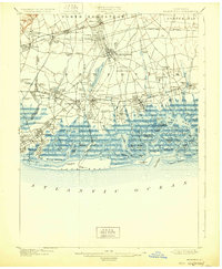
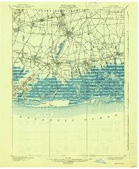
1903 Map of Hempstead
USGS Topo · Published 1909About this map
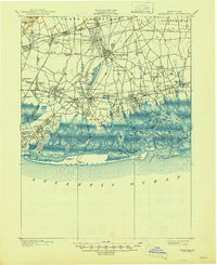
Hempstead and the emerging villages of western Nassau County appear here during a transformative era of suburban transition. The landscape is defined by the extensive rail networks of the Long Island R. R., including the Montauk Division and the Long Beach Branch, which facilitated the growth of planned communities like Garden City and Floral Park. The map documents a complex hydraulic system necessary for regional development, featuring the Hempstead Reservoir, Millburn Reservoir, and numerous smaller ponds such as Simonson Pond and Watts Pond.
Find a feature on this map
126 named features on this map. Tap any name to fly to it.
Don’t see what you’re looking for? This feature index may not catch every label — zoom into the map to look around manually.
Map Details
Editions of this 1903 Hempstead Map
9 editions found
Other maps of this area

1889 · Brooklyn
USGS Topo · 1:62,500

1891 · Brooklyn
USGS Topo · 1:62,500

1891 · Harlem
USGS Topo · 1:62,500

1897 · Harlem
USGS Topo · 1:62,500

1897 · Brooklyn
USGS Topo · 1:62,500

1897 · Hempstead
USGS Topo · 1:62,500

1897 · Oyster Bay
USGS Topo · 1:62,500

1898 · Harlem
USGS Topo · 1:62,500

1898 · Hempstead
USGS Topo · 1:62,500

1898 · Brooklyn
USGS Topo · 1:62,500