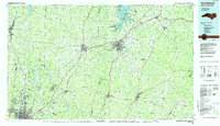
1984 Map of Henderson
USGS Topo · Published 1985About this map
Henderson and Oxford stand as central hubs in this northern North Carolina landscape, connected by a network of rail lines including the Southern and Seaboard routes. To the north, the massive John H. Kerr Reservoir dominates the borderlands, surrounded by local recreation spots like Hibernia State Rec Area and Townsville State Rec Area. The map details a transition from the urban reach of Durham and Gorman in the southwest to the rural, creek-carved terrain of the east. Large institutional footprints are visible, notably the Camp Butner National Guard Range and the Federal Center for Correctional Research. This 1980s data illustrates the region's reliance on its river systems, with the Tar River, Eno River, and Neuse River winding through the Piedmont. Smaller communities such as Louisburg, Roxboro, and Warrenton anchor the surrounding counties, preserved here just before significant late-century suburban expansion.
Find a feature on this map
156 named features on this map. Tap any name to fly to it.
Don’t see what you’re looking for? This feature index may not catch every label — zoom into the map to look around manually.
Map Details
Editions of this 1984 Henderson Map
This is the sole edition of this map. No revisions or reprints were ever made.
Other maps of this area

1902 · Rocky Mount
USGS Topo · 1:62,500

1902 · Spring Hope
USGS Topo · 1:62,500

1904 · Rocky Mount
USGS Topo · 1:62,500

1904 · Springhope
USGS Topo · 1:62,500

1919 · White Plains
USGS Topo · 1:48,000

1920 · White Plains
USGS Topo · 1:62,500

1941 · Clarksville
USGS Topo · 1:48,000

1943 · Durham South
USGS Topo · 1:62,500

1943 · Clarksville
USGS Topo · 1:62,500

1943 · Raleigh
USGS Topo · 1:62,500