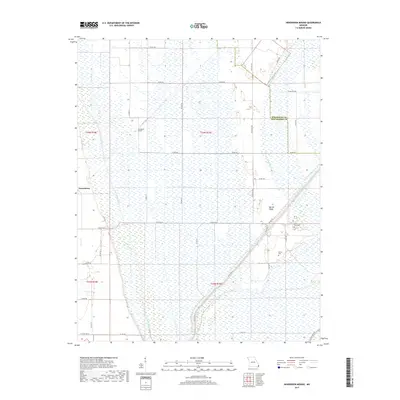
2017 Map of Henderson Mound
USGS Topo · Published 2017About this map
Farrenburg and the agricultural lands of New Madrid and Mississippi counties define this corner of the Missouri Bootheel. The landscape is characterized by an extensive system of man-made waterways, including Saint Johns Ditch, Ash Ditch, and Spillway Ditch, which were engineered to manage the low-lying terrain. These channels surround subtle topographical variations like Henderson Mound and Barnes Ridge, which likely served as crucial high ground during the area's development. For family historians, the map identifies small, localized burial sites such as Cole Cem and Barnes Cem, situated near Black Bayou. The dense network of county roads, such as Co RD 714 and Co RD 716, reflects a strictly organized township and range system that continues to support the region's rural economy.
Find a feature on this map
36 named features on this map. Tap any name to fly to it.
Don’t see what you’re looking for? This feature index may not catch every label — zoom into the map to look around manually.
Map Details
Editions of this 2017 Henderson Mound Map
This is the sole edition of this map. No revisions or reprints were ever made.
Other maps of this area

1931 · Sikeston
USGS Topo · 1:62,500

1934 · Sikeston
USGS Topo · 1:62,500

1939 · Sikeston
USGS Topo · 1:62,500

1939 · Charleston
USGS Topo · 1:62,500

1939 · New Madrid
USGS Topo · 1:62,500

1939 · Bayouville
USGS Topo · 1:62,500

1951 · Bondurant
USGS Topo · 1:24,000

1951 · New Madrid SE
USGS Topo · 1:24,000

1951 · Hubbard Lake
USGS Topo · 1:24,000

1954 · Charleston
USGS Topo · 1:62,500