
1951 Map of New Madrid SE
USGS Topo · Published 1953About this map
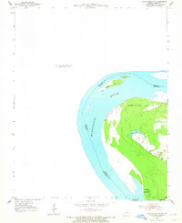
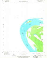
Kentucky Point dominates this 1951 study of a distinctive geographic anomaly where the shifting Mississippi River creates a landlocked portion of Fulton County, Kentucky. This peninsula, nearly surrounded by the river's winding course, is characterized by low-lying bottomlands and small water bodies like Watson Lake. The map captures the intricate state boundaries between Missouri, Kentucky, and Tennessee as they follow the river's mid-channel and former oxbows. Navigation features such as the Madrid Bar and Toneys Towhead illustrate the river's dynamic nature, while a solitary Light and a survey marker at BM 298 provide fixed points for river pilots and engineers in an ever-changing landscape of silt and current.
Find a feature on this map
13 named features on this map. Tap any name to fly to it.
Don’t see what you’re looking for? This feature index may not catch every label — zoom into the map to look around manually.
Map Details
Editions of this 1951 New Madrid SE Map
3 editions found
Other maps of this area

1925 · Reelfoot Lake
USGS Topo · 1:62,500

1939 · Reelfoot Lake
USGS Topo · 1:62,500

1939 · Portageville
USGS Topo · 1:62,500

1939 · New Madrid
USGS Topo · 1:62,500

1939 · Bayouville
USGS Topo · 1:62,500

1951 · Hubbard Lake
USGS Topo · 1:24,000

1954 · New Madrid
USGS Topo · 1:62,500

1955 · Portageville
USGS Topo · 1:62,500

1955 · Bayouville
USGS Topo · 1:62,500

1956 · Reelfoot Lake
USGS Topo · 1:62,500