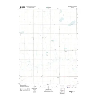
2011 Map of Henderson NE
USGS Topo · Published 2011About this map
Lincoln Creek meanders through this agricultural landscape in York County, defining the drainage patterns that shaped local development. The settlement of Bradshaw is situated in the southeastern corner, serving as a focal point for the surrounding rural sections. The importance of water management in this part of the plains is evident through a series of named water bodies and their associated infrastructure, including Stuhr Reservoir, Driewer Reservoir, and Rech-Smith Reservoir. These reservoirs, managed by structures like the Lundell Dam and Rech-Smith Dam, illustrate the 21st-century irrigation and conservation practices of the region. For those researching local family history, the Plainfield Cemetery remains a significant landmark near the center of the survey area, while the rigid grid of rural roads such as Road A and E 21 Rd reflects the enduring influence of the Public Land Survey System on Nebraska's geography.
Find a feature on this map
33 named features on this map. Tap any name to fly to it.
Don’t see what you’re looking for? This feature index may not catch every label — zoom into the map to look around manually.
Map Details
Editions of this 2011 Henderson NE Map
This is the sole edition of this map. No revisions or reprints were ever made.
Other maps of this area

1896 · Stromsburg
USGS Topo · 1:125,000

1898 · York
USGS Topo · 1:125,000

1899 · York
USGS Topo · 1:125,000

1955 · Fremont
USGS Topo · 1:250,000

1955 · Lincoln
USGS Topo · 1:250,000

1957 · Fremont
USGS Topo · 1:250,000

1957 · Lincoln
USGS Topo · 1:250,000

1958 · Fremont
USGS Topo · 1:250,000

1958 · Lincoln
USGS Topo · 1:250,000

1962 · Polk
USGS Topo · 1:24,000