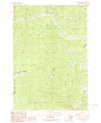
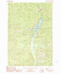
1991 Map of Henderson Ridge
USGS Topo · Published 1991About this map
Henderson Ridge dominates this mountainous landscape along the high border where Idaho meets Montana in the early 1990s. The terrain is divided between the Bitterroot National Forest to the north and the Salmon National Forest to the south, reflecting a wilderness managed for timber and resources. Water sources are critical identifiers in this backcountry, evidenced by named sites like Muleshoe Springs, Tincan Spring, and Grizzly Spring.
Find a feature on this map
29 named features on this map. Tap any name to fly to it.
Don’t see what you’re looking for? This feature index may not catch every label — zoom into the map to look around manually.
Map Details
Editions of this 1991 Henderson Ridge Map
2 editions found
Other maps of this area

1956 · Elk City
USGS Topo · 1:250,000

1960 · Elk City
USGS Topo · 1:250,000

1960 · Painted Rocks Lake
USGS Topo · 1:62,500

1960 · Ulysses Mtn
USGS Topo · 1:62,500

1960 · Shoup
USGS Topo · 1:62,500

1960 · Piquett Mountain
USGS Topo · 1:62,500

1982 · Bighorn Crags
USGS Topo · 1:100,000
1991 · Piquett Mountain
USGS Topo · 1:24,000
1991 · Ulysses Mountain
USGS Topo · 1:24,000
1991 · Painted Rocks Lake
USGS Topo · 1:24,000