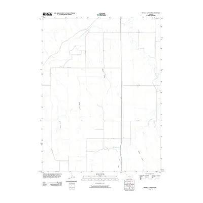
2009 Map of Henkle Canyon
USGS Topo · Published 2009About this map
The South Fork Republican River cuts across the northwest corner of this Cheyenne County landscape, defining a terrain shaped by a series of deep drainages. This high plains environment is characterized by significant erosional features such as Henkle Canyon and Sawyer Canyon, which demonstrate the natural irrigation and drainage patterns typical of the region. The map reveals a highly structured grid of section roads, including Co RD DD and Co RD 27, which overlay the erratic paths of waterways like Big Timber Creek. These road networks reflect the long-standing agricultural organization of the Kansas borderlands, providing access to the various canyons, including Wolfe Canyon, Sleepy Canyon, and Devils Canyon, that fragment the plateau.
Find a feature on this map
16 named features on this map. Tap any name to fly to it.
Don’t see what you’re looking for? This feature index may not catch every label — zoom into the map to look around manually.
Map Details
Editions of this 2009 Henkle Canyon Map
This is the sole edition of this map. No revisions or reprints were ever made.
Other maps of this area

1950 · Mc Donald
USGS Topo · 1:62,500

1951 · Bird City North
USGS Topo · 1:62,500

1951 · Mc Donald
USGS Topo · 1:62,500

1954 · McCook
USGS Topo · 1:250,000

1954 · Goodland
USGS Topo · 1:250,000

1956 · Goodland
USGS Topo · 1:250,000

1957 · McCook
USGS Topo · 1:250,000

1957 · Goodland
USGS Topo · 1:250,000

1958 · McCook
USGS Topo · 1:250,000
1961 · Parks
USGS Topo · 1:24,000