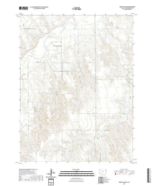
2022 Map of Henkle Canyon
USGS Topo · Published 2022About this map
The S Fork Republican River crosses the northern reaches of this Cheyenne County landscape, defining the local drainage patterns for a series of deeply etched canyons. This high plains terrain is characterized by its prominent natural landmarks, including Henkle Canyon and Sleepy Canyon, which draw from the surrounding plateaus. The sectional grid is clearly defined by a network of rural roads such as Co RD DD and Co RD 27, marking the agricultural divisions typical of Western Kansas.
Find a feature on this map
22 named features on this map. Tap any name to fly to it.
Don’t see what you’re looking for? This feature index may not catch every label — zoom into the map to look around manually.
Map Details
Editions of this 2022 Henkle Canyon Map
This is the sole edition of this map. No revisions or reprints were ever made.
Other maps of this area

1950 · Mc Donald
USGS Topo · 1:62,500

1951 · Bird City North
USGS Topo · 1:62,500

1951 · Mc Donald
USGS Topo · 1:62,500

1954 · McCook
USGS Topo · 1:250,000

1954 · Goodland
USGS Topo · 1:250,000

1956 · Goodland
USGS Topo · 1:250,000

1957 · McCook
USGS Topo · 1:250,000

1957 · Goodland
USGS Topo · 1:250,000

1958 · McCook
USGS Topo · 1:250,000
1961 · Parks
USGS Topo · 1:24,000