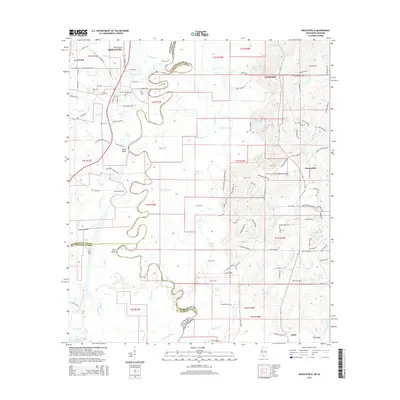
2015 Map of Henleyfield
USGS Topo · Published 2015About this map
The winding Pearl River forms a complex boundary between Louisiana and Mississippi, defining a landscape of dense waterways and rural crossings. On the Louisiana side, Bogalusa and Pools Bluff anchor the western edge, while the Mississippi interior is dotted with small settlements like Henleyfield, Chinquapin, and Cybur. The intricate hydrology of the region is evident in the oxbows and sloughs such as Ox Lot Slough, Dead River, and Hells Gate Bayou, illustrating how the river's historical shifts have created a labyrinth of land and water. Numerous family-named landmarks and cemeteries, including Duffys Cem, Pounds Cem, and McGehee Cem, are scattered across the terrain, offering significant points of interest for genealogists tracing local lineages. The transition from the alluvial bottomlands near Cypress Bayou to higher ground like Pea Ridge reveals a territory historically shaped by its riverine economy and timber access.
Find a feature on this map
130 named features on this map. Tap any name to fly to it.
Don’t see what you’re looking for? This feature index may not catch every label — zoom into the map to look around manually.
Map Details
Editions of this 2015 Henleyfield Map
This is the sole edition of this map. No revisions or reprints were ever made.
Other maps of this area

1942 · Talisheek
USGS Topo · 1:31,680

1942 · Rio
USGS Topo · 1:31,680

1942 · Walkiah Bluff
USGS Topo · 1:31,680

1942 · Pools Bluff
USGS Topo · 1:31,680

1949 · Bogalusa East
USGS Topo · 1:31,680

1949 · Bogalusa West
USGS Topo · 1:31,680

1953 · Mobile
USGS Topo · 1:250,000

1957 · Mobile
USGS Topo · 1:250,000

1958 · Picayune
USGS Topo · 1:62,500

1959 · Bogalusa
USGS Topo · 1:62,500