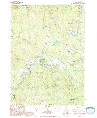
1987 Map of Henniker
USGS Topo · Published 1987About this map
Henniker and its surrounding hill country define this landscape during the late twentieth century, showing a community deeply integrated with the Contoocook River. The settlement pattern follows the river's path, connecting West Henniker and Henniker Junction, while higher elevations are preserved within an extensive network of public lands. Large tracts such as the Harriman-Chandler State Forest and Totten Trails State Forest emphasize the region's commitment to conservation and forestry.
Find a feature on this map
62 named features on this map. Tap any name to fly to it.
Don’t see what you’re looking for? This feature index may not catch every label — zoom into the map to look around manually.
Map Details
Editions of this 1987 Henniker Map
2 editions found
Other maps of this area

1926 · Hillsboro
USGS Topo · 1:62,500

1927 · Concord
USGS Topo · 1:62,500

1927 · Penacook
USGS Topo · 1:62,500

1928 · Mount Kearsarge
USGS Topo · 1:62,500

1929 · Hillsboro
USGS Topo · 1:62,500

1931 · Mount Kearsarge
USGS Topo · 1:62,500

1949 · Portland
USGS Topo · 1:250,000

1949 · Concord
USGS Topo · 1:62,500

1956 · Penacook
USGS Topo · 1:62,500

1956 · Mt. Kearsarge
USGS Topo · 1:62,500