
1969 Map of Henning SE
USGS Topo · Published 1971About this map
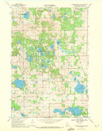
Inman and Oak Valley townships characterize this region of southeastern Otter Tail County, where a complex network of glacial wetlands and drainage systems defines the landscape. The northern portion of the map is marked by the Northern Pacific and Burlington railroad corridors, serving as vital transportation links near the boundary of Deer Creek. The terrain is notable for its extensive conservation areas, including the Inman State Wildlife Management Area and Elmo State Wildlife Management Area, which encompass numerous small lakes and marshlands. Genealogists and local researchers will find several well-defined burial sites across the townships, such as Inman Cem, Trinity Cem, and Oak Ridge Cem. Managed water systems like County Ditch No 49 reflect the local history of land reclamation and agriculture, while natural water bodies like North Lemmerhirt Lake and South Lemmerhirt Lake dominate the southern sections.
Find a feature on this map
22 named features on this map. Tap any name to fly to it.
Don’t see what you’re looking for? This feature index may not catch every label — zoom into the map to look around manually.
Map Details
Editions of this 1969 Henning SE Map
This is the sole edition of this map. No revisions or reprints were ever made.
Other maps of this area

1953 · Brainerd
USGS Topo · 1:250,000

1957 · Brainerd
USGS Topo · 1:250,000

1958 · Brainerd
USGS Topo · 1:250,000

1965 · Brainerd
USGS Topo · 1:250,000

1969 · Henning
USGS Topo · 1:24,000
1969 · Parkers Prairie NW
USGS Topo · 1:24,000

1969 · Heinola
USGS Topo · 1:24,000

1969 · Wrightstown
USGS Topo · 1:24,000

1969 · Wadena
USGS Topo · 1:24,000
1969 · Eagle Bend NW
USGS Topo · 1:24,000