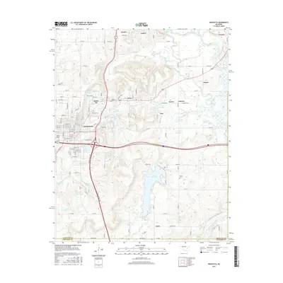
2016 Map of Henryetta
USGS Topo · Published 2016About this map
Henryetta serves as the central hub of this Okmulgee County landscape, where the Indian Nation Tpke and US Route 75 intersect. The area is defined by a series of small industrial and residential settlements that emerged from the region's mining and manufacturing history, including Spelter City, Dewar, Kusa, and Coalton. The topography is marked by numerous water management features, notably Lake Henryetta and the smaller Nichols Lake, alongside dozens of numbered reservoirs like 111074 Reservoir that dot the terrain around Coal Cr and Wolf Cr. Southward, the land transitions toward the North Canadian River valley, with rural markers like Sonora Cem and Salem Cem providing points of interest for genealogical research. The map captures the modern footprint of these established communities, illustrating the dense street grids of the towns contrasted with the winding rural roads leading to places like Grayson and Salem.
Find a feature on this map
84 named features on this map. Tap any name to fly to it.
Don’t see what you’re looking for? This feature index may not catch every label — zoom into the map to look around manually.
Map Details
Editions of this 2016 Henryetta Map
This is the sole edition of this map. No revisions or reprints were ever made.
Other maps of this area

1896 · Okmulgee
USGS Topo · 1:125,000

1900 · Canadian
USGS Topo · 1:125,000

1900 · Wewoka
USGS Topo · 1:125,000

1900 · Okmulgee
USGS Topo · 1:125,000

1901 · Nuyaka
USGS Topo · 1:125,000

1946 · Fort Smith
USGS Topo · 1:250,000

1954 · Oklahoma City
USGS Topo · 1:250,000

1957 · Oklahoma City
USGS Topo · 1:250,000

1962 · Henryetta
USGS Topo · 1:24,000

1962 · Raiford
USGS Topo · 1:24,000