2022 Map of Henryetta
USGS Topo · Published 2022About this map
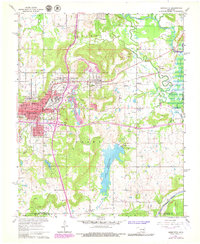
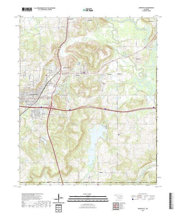
Henryetta serves as the focal point of this Okmulgee County landscape, surrounded by a constellation of smaller communities including Schulter, Dewar, and Spelter City. The map reveals a highly modified hydrology, characterized by numerous numbered reservoirs like 111074 Reservoir and 111039 Reservoir, which sit alongside established water bodies such as Lake Henryetta and Nichols Lake. This intricate network of artificial basins suggests a history tied to industrial water needs or flood control within the Deep Fork and Wolf Creek drainages.
Find a feature on this map
146 named features on this map. Tap any name to fly to it.
Don’t see what you’re looking for? This feature index may not catch every label — zoom into the map to look around manually.
Map Details
Editions of this 2022 Henryetta Map
This is the sole edition of this map. No revisions or reprints were ever made.