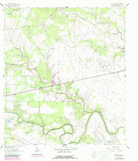
1962 Map of Hensley Lake
USGS Topo · Published 1987About this map
The winding San Antonio River defines the southern boundary of this Goliad County landscape, where the riparian corridor meets an upland dominated by creek drainages and petroleum development. The settlement of Fannin serves as a local anchor, situated near the intersection of historical transit routes and the Fannin Cem. A significant military and aviation footprint is visible at Foster Field (Aband), reflecting the area's mid-century strategic importance.
Find a feature on this map
24 named features on this map. Tap any name to fly to it.
Don’t see what you’re looking for? This feature index may not catch every label — zoom into the map to look around manually.
Map Details
Editions of this 1962 Hensley Lake Map
2 editions found
Other maps of this area

1953 · Beeville
USGS Topo · 1:250,000

1956 · Beeville
USGS Topo · 1:250,000

1960 · Beeville
USGS Topo · 1:250,000

1962 · Live Oak Lake
USGS Topo · 1:24,000

1962 · Fannin
USGS Topo · 1:24,000

1962 · Lott Lake
USGS Topo · 1:24,000

1962 · Melo
USGS Topo · 1:24,000

1962 · Hensley Lake
USGS Topo · 1:24,000

1962 · Goliad
USGS Topo · 1:24,000

1963 · Weesatche
USGS Topo · 1:24,000