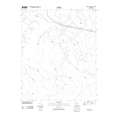
2010 Map of Henson Gap
USGS Topo · Published 2010About this map
Lewis Chapel and the surrounding plateau terrain define this landscape at the head of the Cumberland Plateau in east-central Tennessee. The region's industrial heritage is clearly visible through the presence of several active or former mining operations, including the Mowbray Number 18 Mine, Dayton Number 3 Mine, and Dayton Number 4 Mine. These resource-extraction points are clustered near Taylor Ridge and the upper reaches of Soddy Creek.
Find a feature on this map
72 named features on this map. Tap any name to fly to it.
Don’t see what you’re looking for? This feature index may not catch every label — zoom into the map to look around manually.
Map Details
Editions of this 2010 Henson Gap Map
This is the sole edition of this map. No revisions or reprints were ever made.
Other maps of this area

1888 · Chattanooga
USGS Topo · 1:125,000

1893 · Chattanooga
USGS Topo · 1:125,000

1935 · Daisy
USGS Topo · 1:24,000

1935 · Soddy
USGS Topo · 1:24,000

1935 · Brayton
USGS Topo · 1:24,000

1935 · Mount Airy
USGS Topo · 1:24,000

1936 · Daus
USGS Topo · 1:24,000

1936 · Henson Gap
USGS Topo · 1:24,000

1936 · Ketner Gap
USGS Topo · 1:24,000

1936 · Fairmount
USGS Topo · 1:24,000