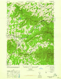
1946 Map of Hensonville
USGS Topo · Published 1946About this map
Windham and the neighboring settlement of Hensonville occupy the central valley of this 1946 study, where the Batavia Kill winds through the high peaks of the northern Catskills. The map illustrates a landscape of narrow hollows and steep ridges, defined by the northern boundaries of Catskill State Park and the prominent heights of Windham High Pk and Black Dome. Small hamlets like Brooksburg and Maplecrest are situated along the valley floors, connected by routes like the Mohican Trail.
Find a feature on this map
42 named features on this map. Tap any name to fly to it.
Don’t see what you’re looking for? This feature index may not catch every label — zoom into the map to look around manually.
Map Details
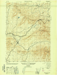
Editions of this 1946 Hensonville Map
2 editions found
Other maps of this area

1892 · Kaaterskill
USGS Topo · 1:62,500

1893 · Kaaterskill
USGS Topo · 1:62,500

1893 · Durham
USGS Topo · 1:62,500

1894 · Kaaterskill
USGS Topo · 1:62,500

1894 · Durham
USGS Topo · 1:62,500

1899 · Kaaterskill
USGS Topo · 1:62,500

1900 · Phoenicia
USGS Topo · 1:62,500

1901 · Gilboa
USGS Topo · 1:62,500

1903 · Gilboa
USGS Topo · 1:62,500

1903 · Phoenicia
USGS Topo · 1:62,500