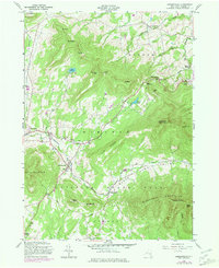
1980 Map of Hensonville
USGS Topo · Published 1981About this map
Hensonville and the surrounding high peaks of the Catskill State Park define this landscape, where deep valleys separate prominent summits like Windham High Peak and Black Dome. The settlement pattern follows the drainages of the Batavia Kill and East Kill, which carve through the Black Dome Valley and the shadows of Cave Mountain. Cultural footprints are visible in the clusters at Maplecrest and Windham, while recreational development is evidenced by Campgrounds near Lake Heloise.
Find a feature on this map
50 named features on this map. Tap any name to fly to it.
Don’t see what you’re looking for? This feature index may not catch every label — zoom into the map to look around manually.
Map Details
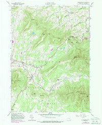
Editions of this 1980 Hensonville Map
2 editions found
Other maps of this area

1892 · Kaaterskill
USGS Topo · 1:62,500

1893 · Kaaterskill
USGS Topo · 1:62,500

1893 · Durham
USGS Topo · 1:62,500

1894 · Kaaterskill
USGS Topo · 1:62,500

1894 · Durham
USGS Topo · 1:62,500

1899 · Kaaterskill
USGS Topo · 1:62,500

1900 · Phoenicia
USGS Topo · 1:62,500

1901 · Gilboa
USGS Topo · 1:62,500

1903 · Gilboa
USGS Topo · 1:62,500

1903 · Phoenicia
USGS Topo · 1:62,500