
1922 Map of Hephzibah
USGS Topo · Published 1922About this map
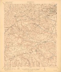
Camp Hancock and its expansive military infrastructure, including a Base Hospital and Arsenal, dominate the landscape southwest of Augusta just after the Great War. This survey reveals a transition from the urban grid and industrial sites like the Richmond Factory Pond to the agrarian stretches of southern Richmond Co. The terrain is interconnected by historic thoroughfares such as Tobacco Road and the Georgia and Florida Road, which served established communities like Hephzibah and Blythe.
Find a feature on this map
79 named features on this map. Tap any name to fly to it.
Don’t see what you’re looking for? This feature index may not catch every label — zoom into the map to look around manually.
Map Details
Editions of this 1922 Hephzibah Map
3 editions found
Other maps of this area

1892 · Mc Cormick
USGS Topo · 1:125,000

1912 · Mc Cormick
USGS Topo · 1:125,000

1919 · Gough
USGS Topo · 1:62,500

1920 · Stapleton
USGS Topo · 1:62,500

1920 · Greens Cut
USGS Topo · 1:62,500

1920 · Clarks Hill
USGS Topo · 1:48,000

1921 · Augusta
USGS Topo · 1:62,500

1921 · Clarks Hill
USGS Topo · 1:62,500

1921 · Appling
USGS Topo · 1:62,500

1922 · Harlem
USGS Topo · 1:62,500