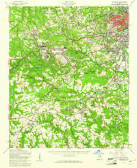
1957 Map of Hephzibah
USGS Topo · Published 1961About this map
Fort Gordon Military Reservation occupies a massive portion of the central landscape, shaping the development of Richmond and Columbia counties during the mid-century. This military footprint is bordered by established communities and agricultural lands, where family legacy is preserved in names like Robert Cem, Malone Cem, and Brothersville Cem. The terrain is defined by its complex drainage into Spirit Creek and McBean Creek, supporting numerous industrial and agricultural water features such as Lombard Millpond and Richmond Factory Pond.
Find a feature on this map
98 named features on this map. Tap any name to fly to it.
Don’t see what you’re looking for? This feature index may not catch every label — zoom into the map to look around manually.
Map Details
Editions of this 1957 Hephzibah Map
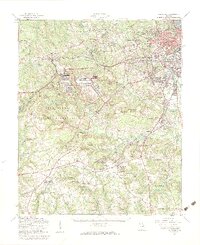
2 editions found
Other maps of this area

1892 · Mc Cormick
USGS Topo · 1:125,000

1912 · Mc Cormick
USGS Topo · 1:125,000

1919 · Gough
USGS Topo · 1:62,500

1920 · Stapleton
USGS Topo · 1:62,500

1920 · Greens Cut
USGS Topo · 1:62,500

1920 · Clarks Hill
USGS Topo · 1:48,000

1921 · Augusta
USGS Topo · 1:62,500

1921 · Clarks Hill
USGS Topo · 1:62,500

1921 · Appling
USGS Topo · 1:62,500

1922 · Harlem
USGS Topo · 1:62,500