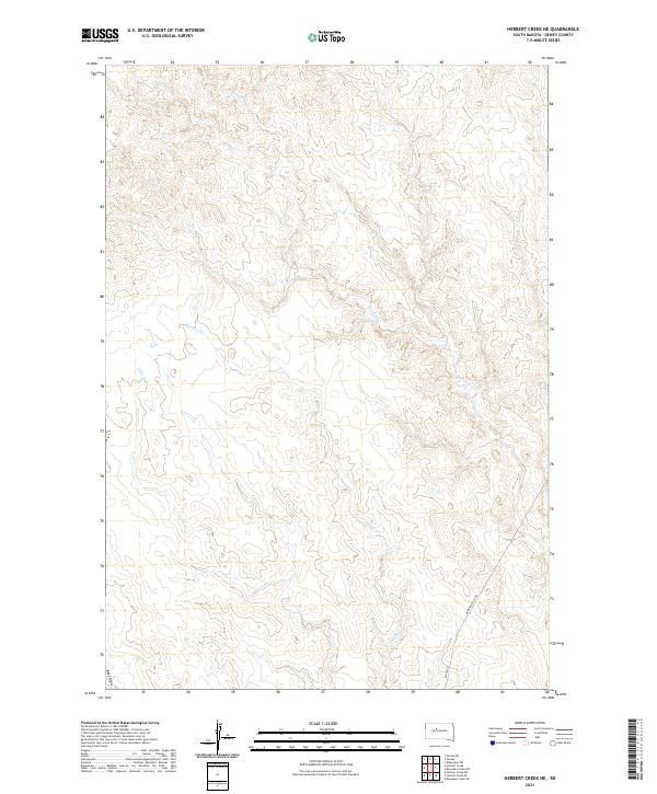
2021 Map of Herbert Creek NE
USGS Topo · Published 2021About this map
Hosupa Cr and Paradis Cr snake across this high plains landscape in Dewey County, defining the drainage patterns of the rural interior. The terrain is characterized by intricate coulees and draws, including the prominently named Beef Draw in the southwest corner. Human presence is sparse, marked primarily by the administrative grid of the Public Land Survey System and a few remote transit corridors. The southern edge of the map is serviced by Armstrong Co Rd and BIA Hwy 9, which provide essential connections across the open range. This map captures a specific moment in the contemporary management of the territory, showing how modern infrastructure like Bureau of Indian Affairs routes integrates with the natural geography of Little Cr.
Find a feature on this map
10 named features on this map. Tap any name to fly to it.
Don’t see what you’re looking for? This feature index may not catch every label — zoom into the map to look around manually.
Map Details
Editions of this 2021 Herbert Creek NE Map
This is the sole edition of this map. No revisions or reprints were ever made.
Other maps of this area

1953 · McIntosh
USGS Topo · 1:250,000

1954 · Pierre
USGS Topo · 1:250,000

1956 · Rousseau Creek SW
USGS Topo · 1:24,000

1956 · Herbert Creek SE
USGS Topo · 1:24,000

1958 · Pierre
USGS Topo · 1:250,000

1958 · McIntosh
USGS Topo · 1:250,000

1981 · Herbert Creek
USGS Topo · 1:24,000

1981 · Rousseau Creek NW
USGS Topo · 1:24,000

1981 · Herbert Creek NE
USGS Topo · 1:24,000

1981 · Parade SW
USGS Topo · 1:24,000