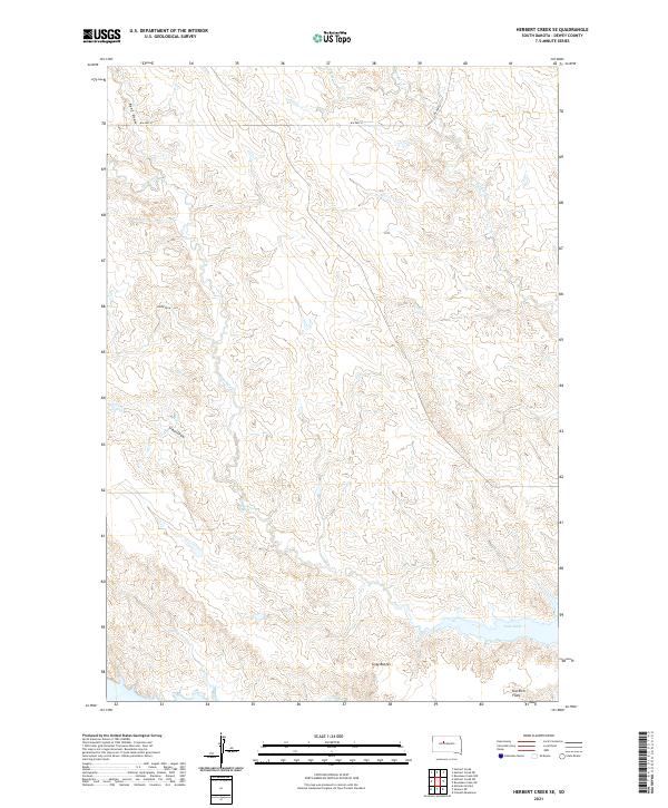
2021 Map of Herbert Creek SE
USGS Topo · Published 2021About this map
Lake Oahe defines the southern edge of this landscape in Dewey County, where the Missouri River's backed-up waters meet the intricate drainage systems of the northern plains. The terrain is characterized by a network of seasonal draws and creeks, including Beef Draw and the namesake Herbert Cr, which carve through the high ground towards the reservoir. Elevated landmarks like the Gray Buttes and Kid Rich Flats provide distinctive topographic relief against the surrounding slopes. Transportation in this part of the Standing Rock reservation area is guided by Bureau of Indian Affairs routes, specifically BIA Hwy 8 and BIA Hwy 9. The map details a complex system of land partitions under the Public Land Survey System, reflecting the intersection of modern infrastructure and traditional land use near features like Paradis Cr and Little Cr.
Find a feature on this map
17 named features on this map. Tap any name to fly to it.
Don’t see what you’re looking for? This feature index may not catch every label — zoom into the map to look around manually.
Map Details
Editions of this 2021 Herbert Creek SE Map
This is the sole edition of this map. No revisions or reprints were ever made.
Other maps of this area

1954 · Pierre
USGS Topo · 1:250,000

1956 · Alleman Station
USGS Topo · 1:24,000

1956 · Rousseau Creek SW
USGS Topo · 1:24,000

1956 · Herbert Creek SE
USGS Topo · 1:24,000

1956 · Sansarc NE
USGS Topo · 1:24,000

1956 · Crockett Mountains
USGS Topo · 1:24,000

1958 · Pierre
USGS Topo · 1:250,000

1981 · Herbert Creek
USGS Topo · 1:24,000

1981 · Rousseau Creek NW
USGS Topo · 1:24,000

1981 · Herbert Creek NE
USGS Topo · 1:24,000