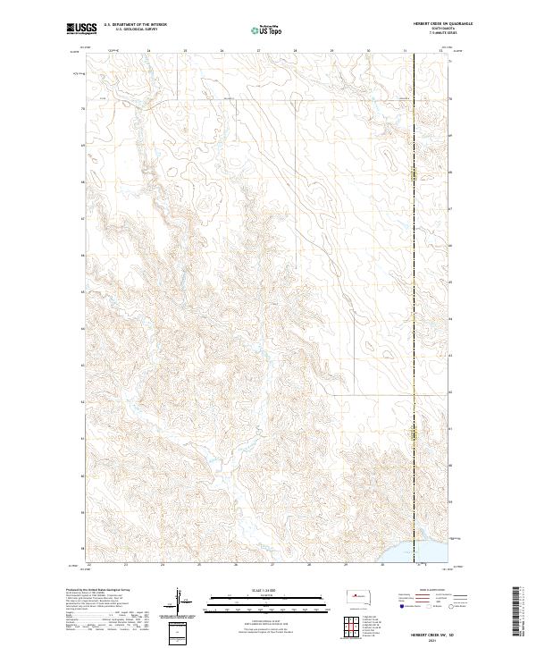
2021 Map of Herbert Creek SW
USGS Topo · Published 2021About this map
The rolling plains of north-central South Dakota are defined here by a series of drainage basins moving toward the Missouri River valley. The landscape is carved by the winding paths of Herbert Cr in the northeast and Rudy Cr to the south, which includes the prominent E Fork Rudy Cr tributary. These seasonal waterways cut through the high prairie, eventually feeding toward the expansive Lake Oahe visible at the southeastern edge of the sheet. Modern infrastructure is sparse, concentrated primarily along BIA Hwy 8, which serves as the primary artery through the region. This 2021 survey also documents the administrative boundary between Ziebach Co and Dewey Co, illustrating how these county lines bisect the open range and agricultural allotments of the Great Plains.
Find a feature on this map
13 named features on this map. Tap any name to fly to it.
Don’t see what you’re looking for? This feature index may not catch every label — zoom into the map to look around manually.
Map Details
Editions of this 2021 Herbert Creek SW Map
This is the sole edition of this map. No revisions or reprints were ever made.
Other maps of this area

1954 · Pierre
USGS Topo · 1:250,000

1956 · Carlin Flat
USGS Topo · 1:24,000

1956 · Alleman Station
USGS Topo · 1:24,000

1956 · Herbert Creek SE
USGS Topo · 1:24,000

1956 · Sansarc NE
USGS Topo · 1:24,000

1958 · Pierre
USGS Topo · 1:250,000

1981 · Herbert Creek
USGS Topo · 1:24,000

1981 · Herbert Creek NE
USGS Topo · 1:24,000

1981 · Herbert Creek SW
USGS Topo · 1:24,000

1981 · High Elk Hill SE
USGS Topo · 1:24,000