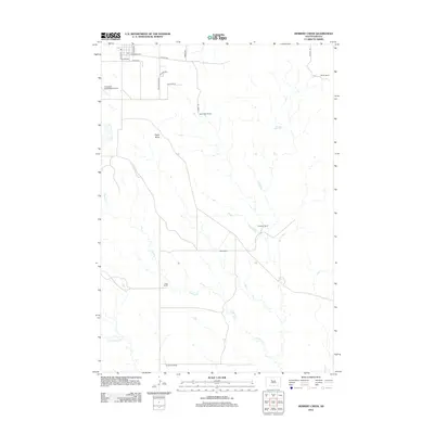
2012 Map of Herbert Creek
USGS Topo · Published 2012About this map
The vast prairie surrounding Eagle Butte and the Cheyenne Eagle Butte Airport is defined by a network of drainage systems and isolated cattle operations. This survey of the landscape shows a rural economy centered on private landholdings, with several family-named ranches like Beef Camp Ranch, Skates Ranch, and the Webb Ranch scattered across the township. The hydrology of the region is traced through the winding paths of Herbert Cr, Timber Crk, and E Fork Rudy Cr, which carve through the open plains. Local transportation is facilitated by named thoroughfares such as Landmark Ave, Plains Ave, and Minnecoujou Dr, providing access to the more remote corners of the quadrangle. The settlement patterns reflect the endurance of Western ranching traditions in South Dakota, where homesteads remain the primary landmarks in an expansive natural environment.
Find a feature on this map
23 named features on this map. Tap any name to fly to it.
Don’t see what you’re looking for? This feature index may not catch every label — zoom into the map to look around manually.
Map Details
Editions of this 2012 Herbert Creek Map
This is the sole edition of this map. No revisions or reprints were ever made.
Other maps of this area

1953 · McIntosh
USGS Topo · 1:250,000

1954 · Pierre
USGS Topo · 1:250,000

1956 · Herbert Creek SE
USGS Topo · 1:24,000

1958 · Pierre
USGS Topo · 1:250,000

1958 · McIntosh
USGS Topo · 1:250,000

1981 · Herbert Creek
USGS Topo · 1:24,000

1981 · Herbert Creek NE
USGS Topo · 1:24,000

1981 · Parade SW
USGS Topo · 1:24,000

1981 · Herbert Creek SW
USGS Topo · 1:24,000
1981 · Parade
USGS Topo · 1:24,000