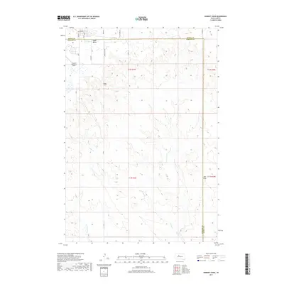
2017 Map of Herbert Creek
USGS Topo · Published 2017About this map
Eagle Butte occupies the northern edge of this landscape, serving as a vital hub where the grid of the town meets the open plains. The settlement's infrastructure is clearly defined, including the Cheyenne Eagle Butte Airport and a network of residential and access roads such as Pioneer Ave, Wambli Dr, and Minnecoujou Dr. This 2017 survey reveals the intersection of municipal development and the traditional ranching landscape of the Cheyenne River Reservation, marked by the prominent county line dividing Dewey and Ziebach counties.
Find a feature on this map
22 named features on this map. Tap any name to fly to it.
Don’t see what you’re looking for? This feature index may not catch every label — zoom into the map to look around manually.
Map Details
Editions of this 2017 Herbert Creek Map
This is the sole edition of this map. No revisions or reprints were ever made.
Other maps of this area

1953 · McIntosh
USGS Topo · 1:250,000

1954 · Pierre
USGS Topo · 1:250,000
1956 · Herbert Creek SE
USGS Topo · 1:24,000

1958 · Pierre
USGS Topo · 1:250,000

1958 · McIntosh
USGS Topo · 1:250,000
1981 · Herbert Creek
USGS Topo · 1:24,000
1981 · Herbert Creek NE
USGS Topo · 1:24,000
1981 · Parade SW
USGS Topo · 1:24,000
1981 · Herbert Creek SW
USGS Topo · 1:24,000
1981 · Parade
USGS Topo · 1:24,000