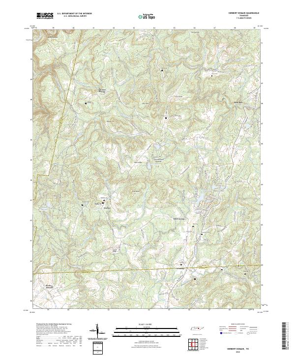
2022 Map of Herbert Domain
USGS Topo · Published 2022About this map
The Cumberland Plateau landscape defines this region, where high ridges like Pilot Knob and Sluter Ridge overlook a network of creek branches and coves. The map documents a scattered rural settlement pattern anchored by small communities such as Thomas Springs and Newton, with family history deeply embedded in the land through numerous small burial grounds including Thomas Springs Cem, Newton Cem, and Burgess Cem Number Two. The transition from Old Winesap to Winesap near the southern boundary illustrates the shifting centers of local life along the winding roads. Water is a constant presence, from the significant Caney Fork in the northwest to Bee Creek and the Twin Lake on the plateau. This 2022 survey preserves the place names of the Herbert Domain, reflecting both public land management and a long history of private family holdings.
Find a feature on this map
141 named features on this map. Tap any name to fly to it.
Don’t see what you’re looking for? This feature index may not catch every label — zoom into the map to look around manually.
Map Details
Editions of this 2022 Herbert Domain Map
This is the sole edition of this map. No revisions or reprints were ever made.
Other maps of this area

1892 · Pikeville
USGS Topo · 1:125,000

1895 · Pikeville
USGS Topo · 1:125,000

1909 · Sequatchie Valley
USGS Topo · 1:62,500

1910 · Pikeville
USGS Topo · 1:62,500

1912 · Crossville
USGS Topo · 1:62,500

1935 · Melvine
USGS Topo · 1:24,000

1935 · Billingsley Gap
USGS Topo · 1:24,000
1935 · Vandever
USGS Topo · 1:24,000
1936 · Crossville
USGS Topo · 1:24,000

1943 · Cookeville
USGS Topo · 1:100,000